England’s Biggest Summer Stories For 2026
07.07.2026From the Women’s T20 World Cup and European Athletics to Aardman’s 50th birthday, Pride celebrations, new live-action attractions and castle-stage...
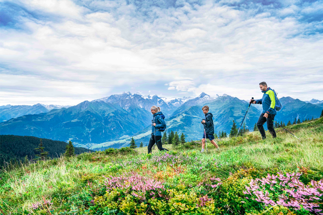
This summer, the Hohe Tauern National Park region has opened an incredible new panoramic trail, bringing visitors to “eye level with Austria’s highest mountains”.
Set within the awe-inspiring region of SalzburgerLand, this 150km trail takes in the area’s best natural attractions, unrivalled Alpine views and cultural delights. For active mountain travellers looking for a unique insight into this mountain playground, this trail is certainly one to put on the list.
The Hohe Tauern Panorama Trail is divided into ten one-day stages, with hikers enjoying plenty of time to explore the individual highlights of each stage – and boy, are there highlights!
With the route covering 7000 metres in altitude, travellers will discover ancient glaciers, spectacular waterfalls and incredible mountain wildlife in the heights of the mountain peaks. Each stage is expected to take hikers around four to seven hours across fairly forgiving terrain, making it a very accessible route for medium to high ability hikers.
Read: 5 Unmissable Reasons to Visit SalzburgerLand
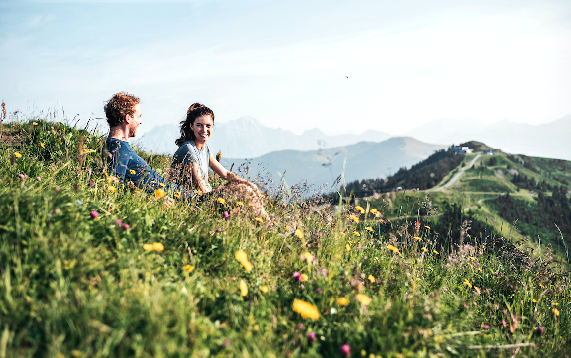
Of course, visitors will also get to enjoy the famously friendly Austrian hospitality with overnight accommodation available all along the route, alternating between valley and mountain locations.
What’s more, sustainable travellers can relax safe in the knowledge that this incredible summer getaway is leaving the smallest ecological footprint, allowing them to enjoy the natural pleasures of this area with a clear conscience.
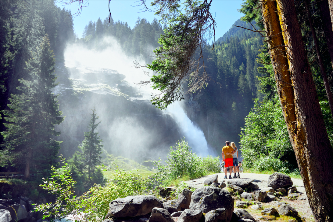
Krimmler Wasserfalls © Ferienregion Nationalpark Hohe Tauern Michael Huber
The adventure begins in Krimml, with a visit to Central Europe’s largest waterfalls. With a drop of 380 metres, this is an exhilarating place to begin your journey, but don’t let this scare you – the hike itself is a fairly gentle one! Cultural highlights along the route include the waterfall trail, the interactive Water Worlds exhibition ‘Wasserwelten’, the Hinterlehengut manor estate and the Oberkrimml birthplace of freedom fighter Anton Wallner.
The longest of the ten stages at over 20km, this trail winds through the stunning Wildgerlostal valley and offers the opportunity to explore more of the Alpine life that calls the valley home. For example, the Leitenkammerklamm gorge, formed by the powerful glacial stream the Wildgerlosbach, provides a habitat for many rare birds, including the water ouzel and grey wagtail.
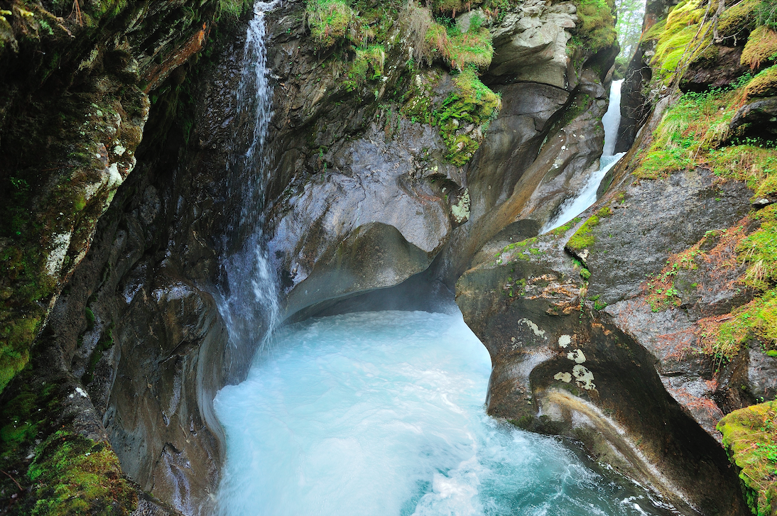
Leitenkammerklamm © Ferdinand Rieder
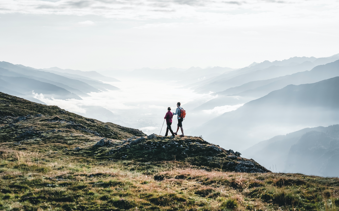
From here, you have the opportunity to take on the Leitenkammersteig climb (one of the most challenging of the trail) or use a gentler alternative route. Be sure to stop off at the charming Trisslalm inn in the Wildgerlostal valley, as well as at the Durlassboden reservoir. This spot marks the border between SalzburgerLand and Tyrol and the tempting turquoise waters will be sure to draw hot hikers in!
This 19.5km route takes you up and across the Alps, at altitudes up to 2,444m above sea level. At the rocky double peak of the Kröndlhorn mountain, you’ll find a beautiful memorial chapel with spectacular panoramic views of over 70 mountain peaks. The path then winds down to the Alpengasthof Rechtegg inn at 1,278 metres where you can rest up for the night.
© Wildkogel-Arena Neukirchen & Bramberg, Daniel Kogler
One of the most challenging stages, this day’s route climbs 1,176m from the Alpengasthof Rechtegg all the way to the summit of the Frühmesser mountain. Here, you can enjoy an unparalleled view of the distant Großvenediger mountain and its expansive glacier fields. This stage ends at the Wildkogelbahn mountain station, where travellers can decide whether to spend the night high in the mountains, take the mountain railways down to the villages in the valley or even descend by slide! Yes, you did read that right – if you alight at the half-way station of the mountain railway, there is a slide path down to the valley, with ten stainless steel slides ready for you to travel in style!
Starting again from the Wildkogelbahn mountain station, this stage again enjoys stunning panoramic views (notice a theme occurring?). Covering 16km, this trail takes you to the southern flanks of the Großer Rettenstein mountain, arguably the most striking in the Kitzbühel Alps. This stage comes to an end at the Panoramaalm on the Resterhöhe mountain, where you can enjoy great views all the way down into the valley to Hollersbach.
© Mittersill Plus GmbH Peter Maier
After a night on the mountain, you’ll trek down to Mittersill, passing a number of interesting highlights, such as the national park exhibition at the Resterkogel cable car and the Wasenmoos natural monument. The latter is home to many rare mountain plants and animals and is well worth a visit during your journey. Once in Mittersill, you simply have to pay a visit to the national park worlds, where a huge area has been transformed into a state-of-the-art alpine adventure area that extends over three levels. This award-winning interactive exhibition offers a unique and informative insight into the natural wonder that is the Hohe Tauern National Park and will allow you to look at your surroundings in a whole new light.
Coming towards the latter end of the trail, this stage takes you back up to the mountains along remote idyllic paths. You’ll ascend 1,300m in altitude to reach your destination, Bürglhütte. This mountain lodge is nestled at the foot of the Gaisstein, one of the highest green-pastured mountains in Europe, looking over the national park village of Stuhlfelden.
© Harry Liebmann
A day of high altitude exploration, this 10km route maintains an altitude of around 2,000m as you traverse the Pinzgauer Spaziergang walk and drink in the magnificent views of the Hohe Tauern and the Großglockner mountain – Austria’s highest. This stage ends at the Uttendorfer Hochsonnbergalm, where travellers can hop on the shuttle into the valley to rest up for the night.
Had your fill of views? You’ve seen nothing yet.. This stage continues along the Pinzgauer Spaziergang trail towards Schmittenhöhe, Zell am See. Enjoy 15km of gentle Alpine meadows and mountain peaks until you finally reach your destination, the Pinzgauer Hütte lodge. Here you will find one of the most spectacular panoramic views of the entire trail, taking in the national park towns of Niedernsill and Piesendorf.
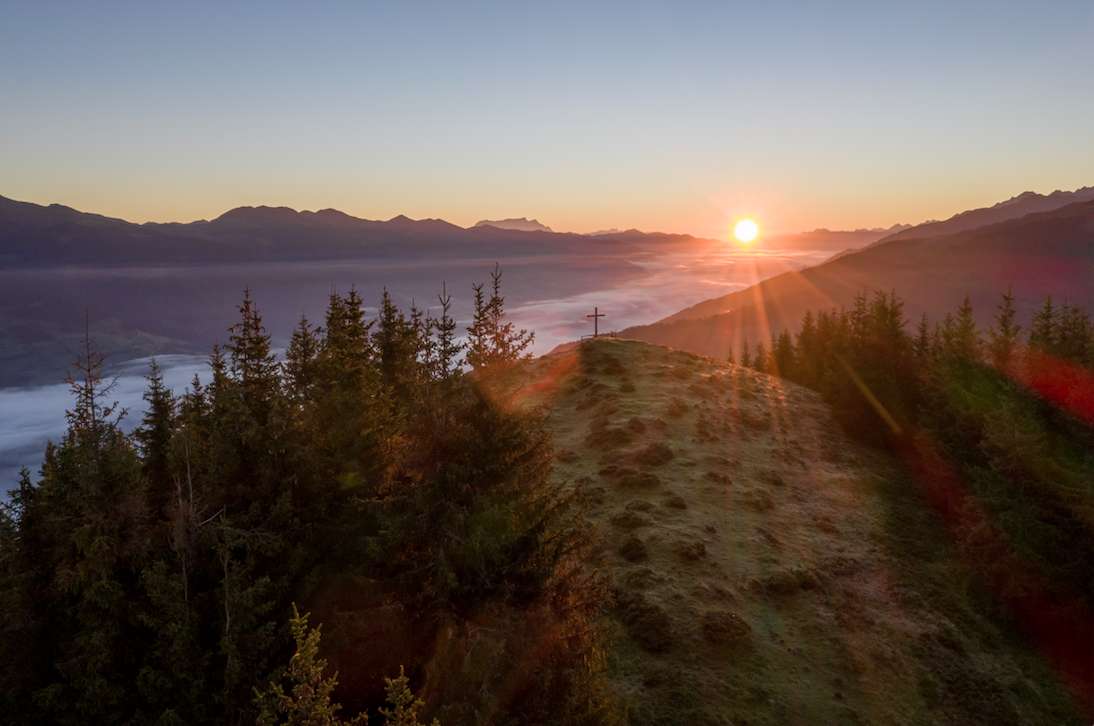
On your final day, you can follow in the footsteps of Empress Sisi, who famously hiked up herself to enjoy the sunrise from the Schmittenhöhe mountain. Now you can do the same, exploring the Elisabeth Chapel at the summit before heading down to your final destination. Take in the beauty of the Höhenpromenade and the themed trail “Mystischer Sagenwald”, before you finally reach the Elisabeth Park on the shores of the lake and your ultimate destination in Zell am See.
© Zell am See-Kaprun Tourismus
Bookings can be made via the individual platform www.hohetauerntrail.at.
Accommodation categories, length of stay, shuttle services and luggage transfer can all be booked individually, or you can book packages of varying journey lengths.
The Hohe Tauern Panorama Trail is well signposted, and guests are provided with all the maps they need and a tour guide with detailed descriptions. The GPS data is available for free download.
To find out more about SalzburgerLand, visit salzburgerland.com
Featured Image © TVB Wald Königsleiten
Enjoyed this article? click here to get more from us
From the Women’s T20 World Cup and European Athletics to Aardman’s 50th birthday, Pride celebrations, new live-action attractions and castle-stage...
With much of Europe facing more frequent summer heatwaves, the appeal of a mountain holiday in July and August is...
Framed by crystal-clear lakes, soaring Alpine peaks and the iconic Mont Blanc, the region of Haute-Savoie Mont-Blanc offers a compelling...
Ötztal’s Bike Republic Sölden is opening two new trails and celebrating the sporting highlight of early summer on occasion of...